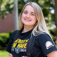


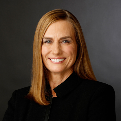
Jessica Despres ’21
Alumna Turns Passion for Audio into Working on Emmy®-Winning Shows at ESPN
At the University of New Haven, everything from our distinguished academic programs to our professors’ commitment to fostering professional development is designed to propel students into their careers. Our unique educational approach provides students with the skills, tactical experience, and network to become tomorrow’s pioneers.

Funding awarded by Connecticut’s Community Investment Fund 2030 Program is the fourth largest grant awarded in the latest round of funding distribution and the largest awarded to a college or university in the state.
The University of New Haven is partnering with commercialization experts FORGE and mentorship program NextMinds to offer student inventors a tuition-free college degree and a clear path to commercialization.
Janet Jensen ’17 Hon. discusses the $4 million gift she made to the University to support the establishment of the Jensen Community Center for Applied Justice as well as the development of survivor-center initiatives to combat human trafficking that can be scaled and shared nationwide. President Frederiksen spoke in the video piece about the impact of Ms. Jensen’s generosity.
Matthew Schmidt, associate professor of homeland security, international affairs, national security, and political science, discusses the latest on the wars in Ukraine and Iran.

Take one more look back at the sights and sounds as we celebrated the Class of 2026 during Commencement.

Heading into Commencement, we asked Dora Crespo ’26 a few questions about her time as a Charger and what her plans are for the future.
Alumna Turns Passion for Audio into Working on Emmy®-Winning Shows at ESPN

Graduate Student Presented Community-Engaged Research at Rural Health Conference

From the Classroom to the National Spotlight: MPH Candidate Shares Research Journey
Find out more about why the University of New Haven is a great fit for you. Our admissions team will contact you with information personalized to your interests.
A campus visit is one of the most important parts of the college selection process. Come feel what it's like to Be a Charger!
With more than 70,000 alumni and more than 100 years of history, #ChargerNation is the place to be. Begin Your Journey today.
The University of New Haven admits students of any race, color, national and ethnic origin to all the rights, privileges, programs, and activities generally accorded or made available to students at the University. It does not discriminate on the basis of race, color, national and ethnic origin in administration of its educational policies, admissions policies, scholarship and loan programs, and athletic and other school-administered programs.