University Hosts Immersive Satellite Imagery Workshop
Satellite imagery is becoming an increasingly valuable tool in many fields, and several Chargers recently had the opportunity to learn how to apply it to do everything from tracking the conflict in Ukraine to determining whether images had been tampered with.
April 25, 2024
By Renee Chmiel, Office of Marketing and Communications
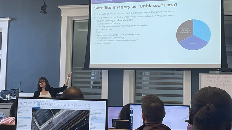
Michelle Fabiani, Ph.D., discusses the importance of satellite imagery as part of the workshop.
As Rachel Swanson ’24 examined the satellite images before her, she was learning how to decipher what was in them, as well as whether they’d been altered. It was a unique and exciting opportunity for her to build her skills while learning with and from her fellow Chargers.
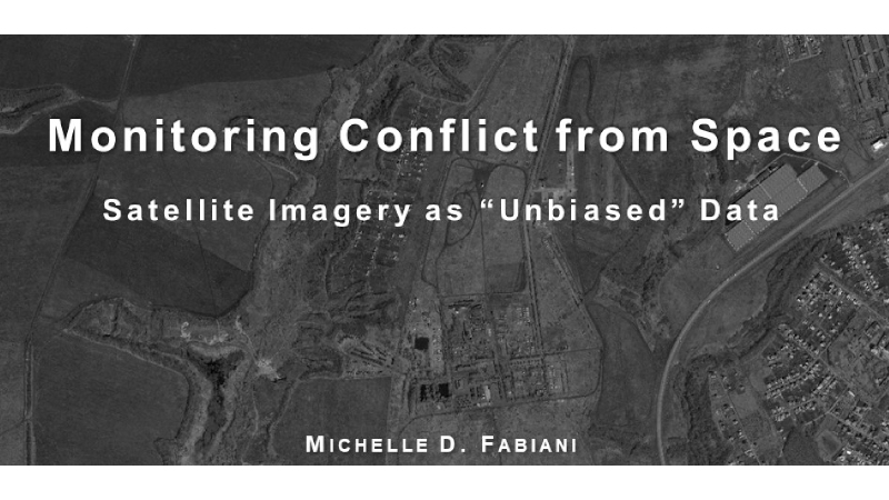
The session was part of an interdisciplinary workshop that was recently held on campus. Titled “Monitoring Conflict from Space: Satellite Imagery as ‘Unbiased” Data,’” it brought together students and faculty for a timely discussion about the importance of satellite images and how they can be a vital tool in many fields, from national security and political science to environmental science.
“Being able to use this knowledge is important because it can be beneficial to know how to look at an image,” said Swanson, a criminal justice major. “I enjoy getting to learn from experts who can teach me different forms of analysis that I can carry with me into my career.”
A rare opportunity
Interest in the use of satellite images has been increasing, and imagery is becoming more readily available. Professionals in a variety of fields are turning to satellite imagery as a critical source of data. As part of the workshop, participants explored real-life situations and events. They tracked the development of Russian military forces along the border of Ukraine in 2014 and explored how the data can inform our understanding of the geopolitical situation in the region then and now.
Dr. Fabiani’s research focuses on developing the tools and methods to mitigate and prevent crime, exploring topics such as human smuggling, domestic terrorism, and archaeological looting in conflict zones. Her work integrates technology-driven data collection, historical analysis, and complex quantitative methods – including satellite imagery. She was excited to share her expertise with her fellow Chargers.
“The workshop was well attended, and the participants particularly appreciated the opportunity to work directly with satellite imagery,” said Dr. Fabiani. “It is rare for students or faculty to get to work with raw imagery and to see how the data created from them can be used in making decisions or in a forensic investigation.”
‘A unique skill’
As part of the workshop, participants also learned how to use satellite imagery to generate spatiotemporal data on geopolitical events using the software ArcGIS Pro. The workshop offered a unique opportunity for them to learn to evaluate satellite imagery in the media to determine the authenticity of images.
For Swanson, the criminal justice major, the workshop was expansive, enabling her to build her skills and her network. She enjoyed the immersive learning opportunities it offered.
“This helps me make connections with other people and offers me a unique skill to be able to present what I can do,” she said. “Being able to examine satellite images and tell others what could be wrong with them can create advantages in many ways. This workshop also allowed me to consider how many different ways satellite imagery can be used and the possible good it could do.”